Reporting and Data Sharing
Leveraging the automation provided by the flight application and object detection models makes generating the results of your observations fast and accurate. Polli’s intuitive report view, along with available spreadsheets and PDF reports, make getting the information you need easy and fast.
Contact Us
All the Reports You Need, In One Place
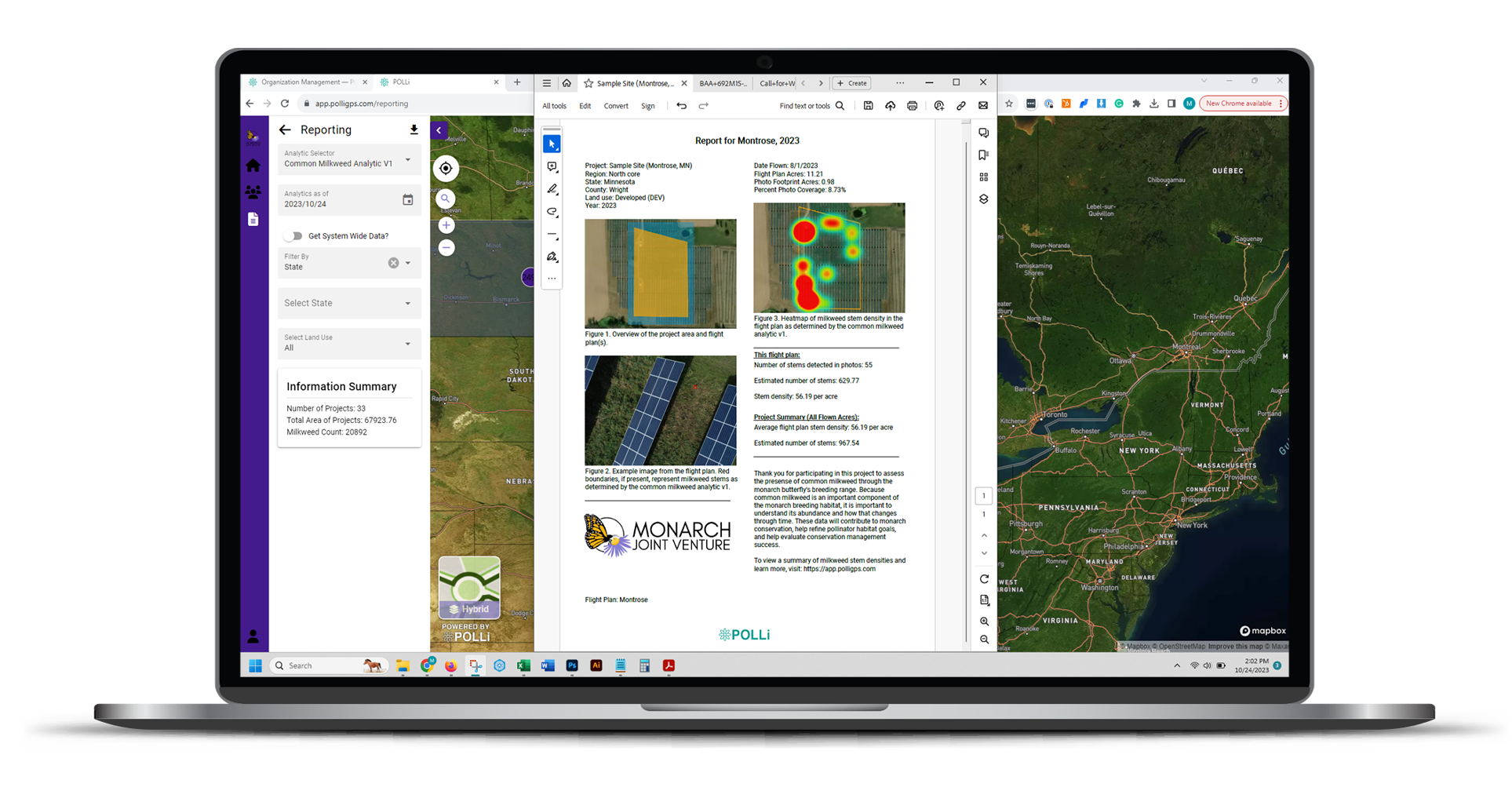
Polli App: All the site data your organization has, as well as any information share with your organization will be available to visualize in the Polli app. Additionally, an easy to use filtering system lets you drill down to the data you need, fast.
Spreadsheet (.CSV): Need your data, but want to manipulate it using your favorite spreadsheet software? No worries. All of your organizaiton’s data is available a downloadable CSV.
Landowner’s Report: Keep your supporters updated on the counts produced from their land with the Landowner’s Report. Quickly show results, heatmaps, as well as field and flight statistics in a simple to share PDF.
Customizable: Need something different? Reach out to us. We want to hear how we can make Polli better for all different conservation groups around the world. Our skilled development team is able to respond to requests quickly.

Our mission is to make field data collection fast, easy, and robust. We want to put drones and artificial intelligence in your organization’s toolbox.
Multiple, In-depth Reports Available
Our initial reporting was driven by our conservation partners during development. The aim was to give the users all the information they needed to report and track conservation progress, as well as deliver high-quality reports to landowners.
Polli Data Viewer
Spreadsheets
Landowner’s Report (PDF)
The reports you need - fast


