


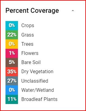
Habitat Index
The habitat index algorithm is designed to look at every pixel in an image, and characterize across nine different options, including grass, flowers, dry vegetation, bare soil, etc.
The use cases for the habitat index are limitless as it generates useful data across multiple industries such as conservation, ROW/vegetiatoin management, and more!
Habitat Index
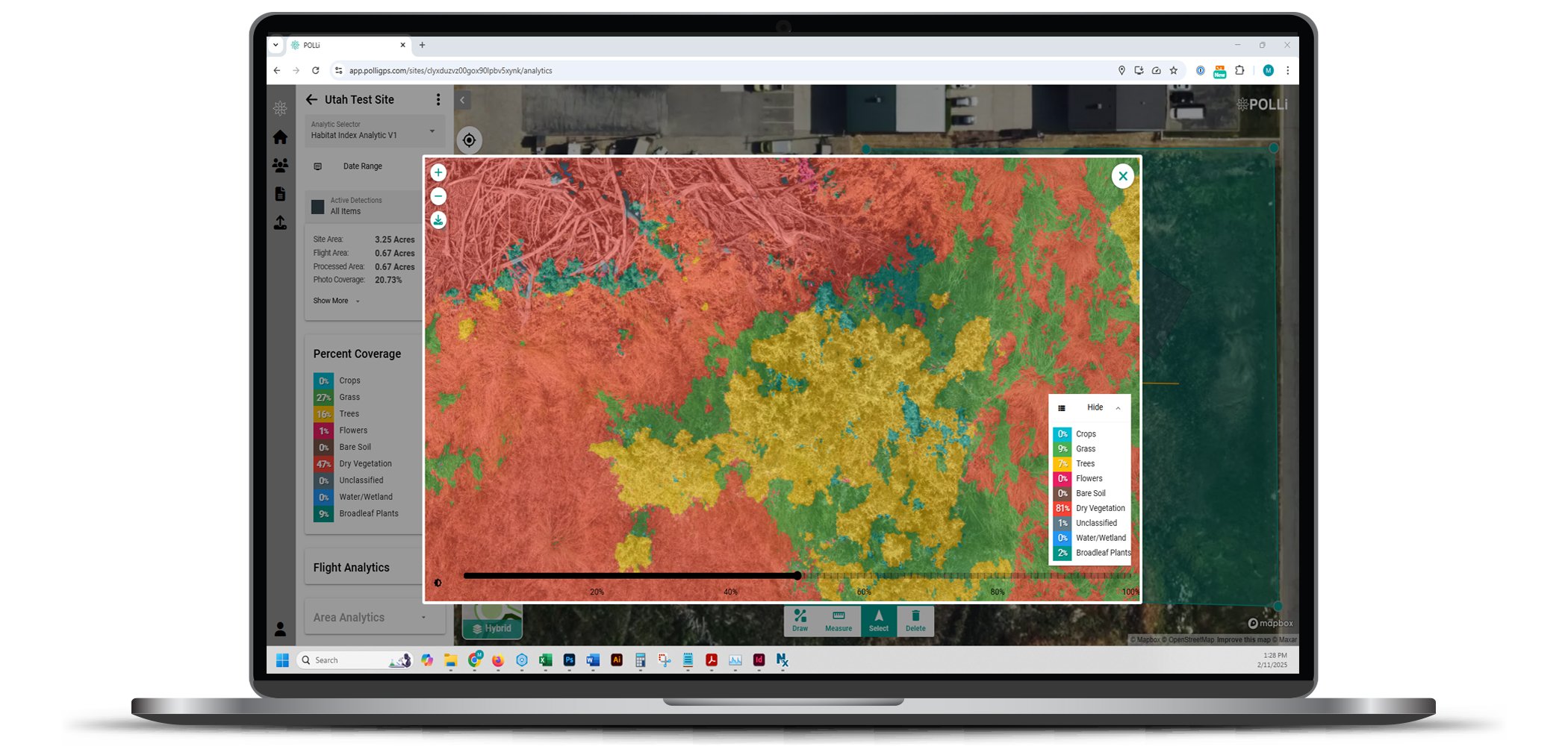
New in 2024 is the characterization of each pixel in an image divided into nine different classifications. Then a percentage of each of these classifications are identified in an image and the classifications are produced as a data layer.
Key Features:
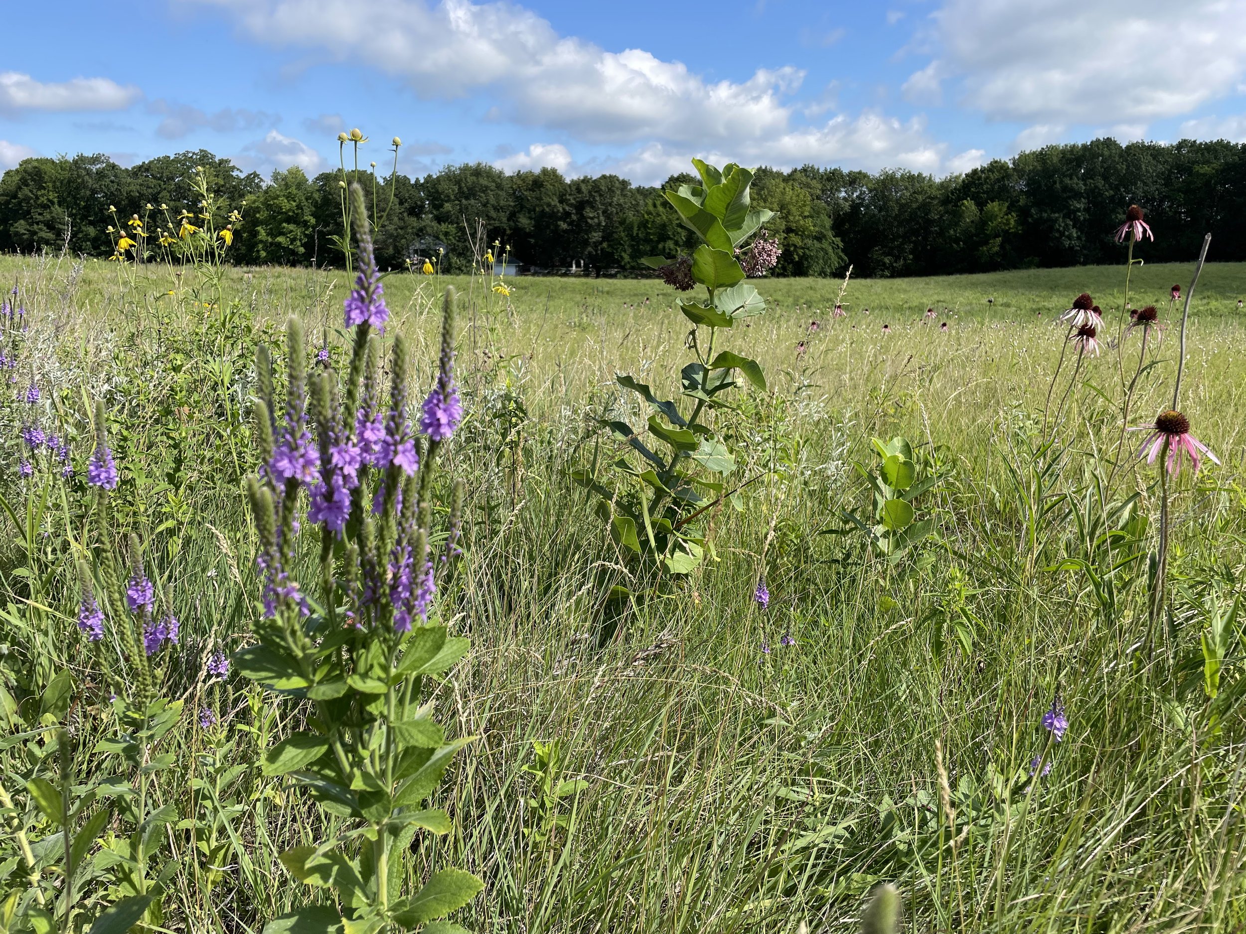
Detailed Classification: The algorithm is adept at analyzing image data to categorize different grassland habitat components meticulously.
Versatile Applications: Whether you're examining Conservation Reserve Program (CRP) acres, roadway corridors, railway paths, gas/electric distribution corridors, or solar electric generation farms, the Floral Resources algorithm is equipped to provide invaluable insights into the intricate makeup of these landscapes.
Benefits to Users:
Efficiency - The data can be what drives your dispatching and work orders. Delivering your vegetation management teams to areas that need control.
Planning & Risk Management - Using dry vegetation indicators to assist with the planning of prescribed burns, or assisting in strategies to maintain or control a burn before it is started.
Holistic Habitat Understanding: By understanding the diverse components of grasslands, users can better and less expensively report for regulatory requirements or make more informed decisions about conservation, land management, and research.
Support for Biodiversity: The algorithm's detailed classification is essential for maintaining biodiversity. Identifying specific floral resources can guide efforts to preserve habitats crucial for various pollinators and other species.
Enhanced Conservation Strategies: With accurate data on floral resources, conservationists, land managers, and other stakeholders can design tailored strategies for habitat preservation and restoration.
Collaborative Research: POLLi's standardized approach ensures that different users can share, compare, and collaborate on data, fostering a collective effort towards grassland conservation.
Efficacy Evaluation: Comparing the progress of a restoration project throughout a season, or monitoring over time with a consistent and accurate evaluation is measured and reported quickly.
Embrace the Future of Grassland Conservation
POLLi's Habitat Index algorithm isn't just a technological advancement—it's a commitment to the future of our planet. For all stakeholders, from conservationists to land managers and researchers to energy producers and distributors, this tool offers a reliable method for understanding and preserving one of the Earth's most diverse and essential ecosystems. Join us in shaping a sustainable future, one grassland at a time.

Sign up for a free account today, and take Polli for a test drive. No cost to get setup and see how Polli could help your organization.
